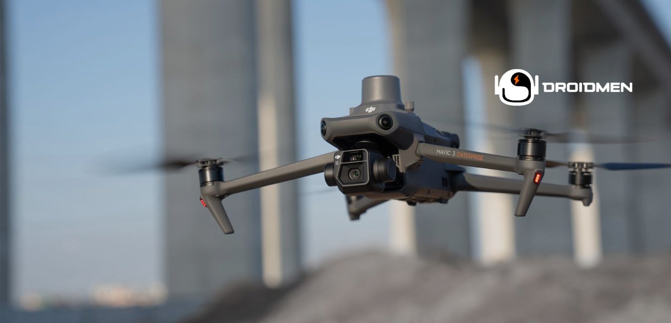
You need a great drone when you need to map a big area from the sky. A drone can fly high and take pictures or videos of the land. These pictures help people make maps and understand places better.
They help us make maps of farms, cities, and forests. Some drones do this job really well. They fly up high or down low to take many pictures. Then, people put these pictures together to see what places look like from above.
We will talk about 5 of the best drones for mapping. These drones are like superheroes of the sky.
Table of Contents
Top 5 Drones For Mapping
DJI Phantom 4 RTK
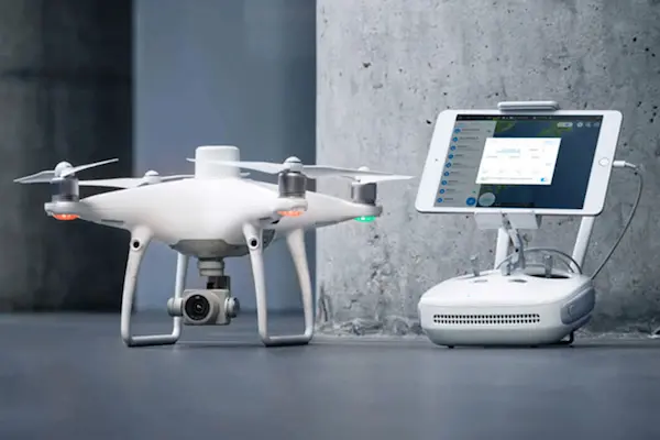
Do you want to make a map with a drone? The DJI Phantom 4 RTK is one of the best for this job.
The DJI Phantom 4 RTK has a camera that sees things very well. It can take clear pictures from up high. This means you can make great maps with lots of detail.
This drone knows precisely where it is because it uses special signals from satellites. It can tell its spot within just a few inches! This drone can fly for about 30 minutes before it needs a battery change.
It’s not heavy, so you can easily carry it to different places. The DJI Phantom 4 RTK can see things in its way, too. It won’t bump into trees or buildings. People who make maps for work really like this drone.
They say it helps them do their job well. You don’t need to be a pro to use it, which is excellent news for everyone. When you use the DJI drone, you see things from way up in the sky.
It’s like being a bird but even better because you can make a map of what you see! This drone is a helper for people who need to know how land or cities look from above.
DJI Matrice 300 RTK
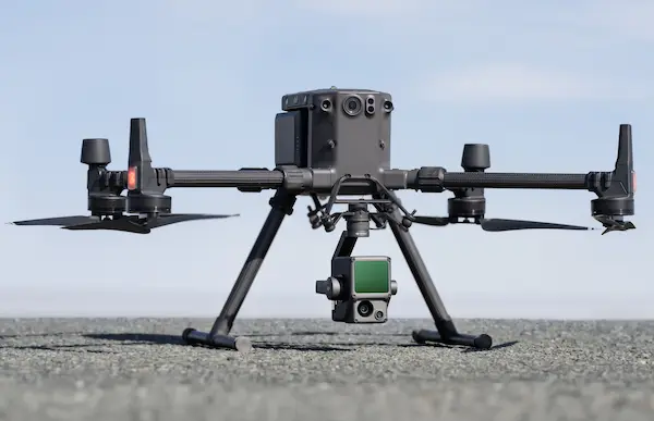
The DJI Matrice 300 RTK drone is like a super helper in the sky for making maps. It can fly for up to 55 minutes. That’s almost one full hour!
It can see things around it, so it won’t bump into birds or trees. This drone can carry three cameras at once. This means you can look at many things from the sky in one trip.
You will like how this drone can fly far and return home all by itself. It is strong and can fly in the rain. You can also use it at night.
The drone has lights, so you can see it in the dark. People who make maps for work think this drone is great. It helps them make very good maps. They can see every hill, house, and road.
This drone is very smart. It can fly by itself and take a lot of pictures without missing any spots. When you have a big job, this drone works like a champ. It makes the job easier and faster.
You can trust this drone to help you with big projects. It is a good friend for people who need to make maps.
Autel EVO II Pro RTK V3
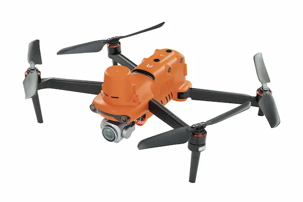
The Autel EVO II Pro RTK V3 is a drone that takes mapping to the sky. Think of it as a flying camera that takes super clear pictures from up high. This drone can fly for 40 minutes.
That’s a lot of time to take many pictures of the ground. This drone sees things very well. It has a camera that can take 6K videos. That’s like a super-sharp eye that misses nothing.
It also stays safe while it flies because it can see what’s around it. It won’t bump into trees or buildings. People who make maps love this drone. It is very exact.
It knows where it is when it flies, down to the tiniest bit. This means the maps it makes are excellent. You can see every path, house, and tree.
Even if you never flown a drone before, this one is easy to use. You can learn to fly it fast and start making maps. The Autel EVO II Pro RTK V3 is not just for experts.
It is also for anyone who wants to start mapping the world from above. With this drone, you can go out and make great maps.
Yuneec H520 RTK
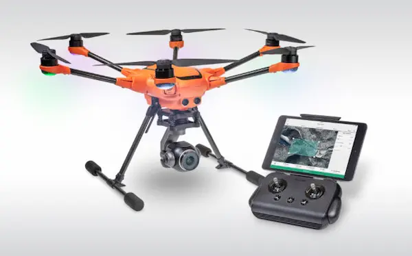
Mapping the land from the sky is a big job. You need a good drone to do it. The Yuneec H520 RTK is a drone that helps people make maps. It is a smart choice for this work.
This drone has six arms and can stay in the air for up to 28 minutes. It can fly far away, but you can always see where it is. The camera is very good. It takes clear pictures.
You can change the camera if you need to. This is great because you can choose the best camera for your work. The drone is orange, which makes it easy to see in the sky. It flies smooth and straight.
This helps it take better pictures. The Yuneec H520 RTK also knows how to avoid things that could hit it. This keeps the drone safe. People use this drone for construction, to look at farms, check on buildings, and make maps.
It does a good job and is relatively easy to use. When you need a map from the sky, the Yuneec H520 RTK is a great helper.
It can go where you tell it and bring back pictures that show everything you need to see.
DJI Mavic 3 Enterprise
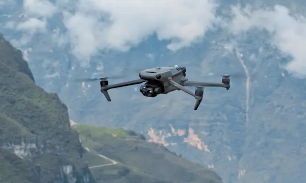
The DJI Mavic 3 Enterprise is a top drone for mapping. It is new and better than the older DJI Phantom 4. This drone stands out because it has a special camera.
The camera can take clear and sharp pictures from the sky. This helps a lot in making good maps.
The Mavic 3 Enterprise can fly for a long time. It can stay in the air for up to 45 minutes. This means you can map big areas without needing to land the drone to change its battery.
It also flies very far. You can control it from up to 15 kilometers away. This is great for mapping large places. This drone is easy to use. It comes with smart features that help it fly safely.
It can see and avoid things like trees and buildings. This keeps the drone safe while it works. You can fold it, too, so it’s easy to carry around.
People who need to make maps for work will find the DJI Mavic 3 Enterprise very useful. It works well for many jobs.
You can use it for making maps, checking on farms, or even for rescue missions. This drone makes hard jobs easier and helps people do their work better.
FAQs
1. What Is A Mapping Drone?
A mapping drone is an unmanned aircraft equipped with sensors to capture aerial data. It creates detailed maps by photographing terrain with precision. These drones are used in agriculture, construction, and surveying to collect accurate geographical information quickly and efficiently.
2. Why Do I Need A Drone For Mapping?
Drones for mapping are essential as they quickly capture high-resolution aerial images over large areas. This efficiency is unmatched by traditional methods. They provide detailed data for accurate maps, essential for planning, construction, and agriculture, making them a valuable tool for professionals in various fields.
3. Can All Drones Be Used For Mapping?
Not all drones are suitable for mapping. For effective mapping, a drone must have a high-quality camera, stable flight capabilities, and long battery life to cover large areas. Specialized mapping drones also offer GPS precision and software for creating detailed maps.
Conclusion
The best drones for mapping make our work easier and faster. They take clear pictures of the sky. This helps us make good maps.
Remember, when you choose a drone, think about what you need. Do you need long flight times? Do you need clear pictures? The right drone can do a lot for you. Pick the one that fits your job best.
Are you looking for a relevant blog? Check out the following: